- Inspire
- Innovate
- Integrate
- Home
- Tarsheed Solutions Engineering Consulting Company
- 3D Laser Scanning Services
3D Laser Scanning Services
Conserve offers 3D Laser Scanning services in the Kingdom of Saudi Arabia transforming the way as-built drawings / BIM Models are generated in the AEC industry.
Scanning & Scan to BIM
Conserve has the potential & experience to deploy latest 3D Laser Scanning technologies with high accurate proximity data wherever field measurements for as-built generation is a requirement. 3D laser scanning of constructed components / structures enables AEC industry to accelerate the as-built documentation process while improving the accuracy and reducing costs.
Generated 3D laser scans on-site shall be then used for variety of applications including progress recording, deviation analysis, stockpile measurements, as-built generation, etc. Produced high definition 3600 data gathered in short spans of time (comparing with conventional red-line mark-up techniques) forms an asset to the property Owner, enables further decision making during construction and operational phases of the project.
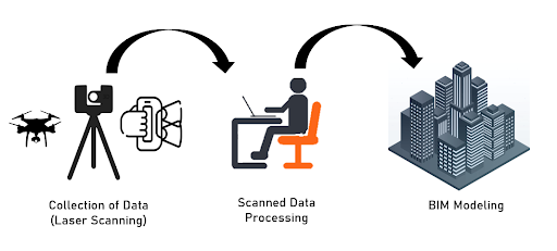
Below are the stages of 3D Laser Scanning implementation,
Data Collection
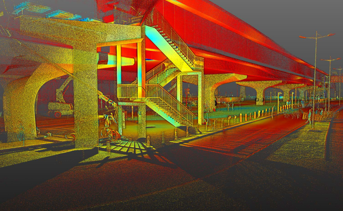
Laser Scanning process will be initiated with setting-up digital total survey stations to validate scanner positions for areas to be captured. The surveys taken with dimensional control methodologies offer a higher standard of precision, ensuring that the resulting point cloud has accuracy ranges between 2 – 5 mm. Further, 3D Laser Scanning device captures 3600 measurements with millions of point coordinates per second, collected data will be further transferred to high-end workstations for further processing.
Data Analysis & Processing
Collected data will be further analysed and processed using the state-of-the-art processing tools where individual scans are cleaned and merged together to form a Point Cloud Model which in turn suits importing modes in BIM Applications.
3D scanned data can be integrated with other information in CAD, GIS & Web platforms where it can be used by engineers to make informed real time decisions. When integrated with BIM, the point cloud model allows the project team to quickly and accurately analyze & access the project conditions prior commencing the design process. The 3D point clouds shall be converted into a comprehensive Building Information Model and further into 2D Drawings as per project requirements/specifications.
Benefits
Rapid data collection
Savings in Schedule & Budget
Reduces manual errors
Faster Transfer of data
Non-Contact data capture
Effective documentation, better collaboration and coordination
Applications
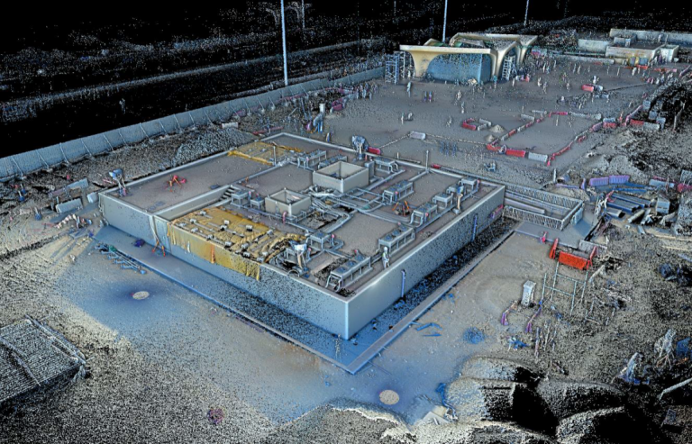
Buildings – Architecture, Structure, MEP and Utilities Infrastructure
Urban Planning
Infrastructure – Bridges, Highways & Transportation
Off-shore – Oil Rigs & Vessels
Industrial Applications – Power Stations / Power Plants
Features
Photo Measure: Real-time meaurements from Photos Point to Point: Measures distances between objects Measure Remote Objects and Collect GPS/GNSS Locations from a distance
Quick Links
Copyrights © 2026. Conserve Solutions. All Rights Reserved.
BIM Data, Cost & Handover Services
BIM Coordination & Constructability
BIM Modelling & Digital Delivery
Discipline BIM Modeling (Architectural, Structural, MEP)
BIM Automation & Digital Engineering
BIM Data, Cost & Handover Services
Structural & Steel Detailing Services
Architectural Design, Visualization & Presentation Support
BIM Coordination & Constructability
BIM Modelling & Digital Delivery