- Inspire
- Innovate
- Integrate
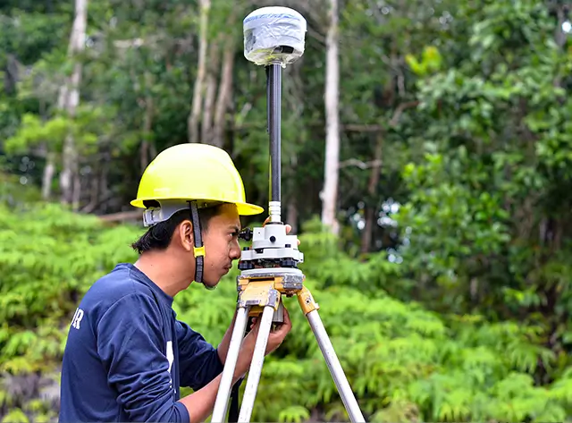
Conserve Solutions offers a comprehensive range of Geospatial and Photogrammetric Services that support planning, design, asset management, and infrastructure development. Our services are built on the foundation of accuracy, speed, and cost-effectiveness. Leveraging Advanced technology and an experienced team, we deliver high-quality mapping and spatial analysis solutions across multiple geographies.
Services We Provide
Our Drafting Services cover
Geospatial Services
- Aerial Triangulation
- 3D City Modelling
- Contour Mapping
- Digital Terrain Model (DTM) & Digital Elevation Model (DEM) Generation and Editing
- Topographical Mapping
- 2D & 3D Planimetric Extraction
- Orthophoto Generation
- GIS Data Capture, Processing, and Support
Geospatial Services
- Aerial Triangulation
- 3D City Modelling
- Contour Mapping
- Digital Terrain Model (DTM) & Digital Elevation Model (DEM) Generation and Editing
- Topographical Mapping
- 2D & 3D Planimetric Extraction
- Orthophoto Generation
- GIS Data Capture, Processing, and Support
Photogrammetric Services
- Utility Mapping
- City and Municipal Mapping
- Cadastral Mapping
- Digital Photogrammetry
- Terrain Modelling
- 3D Visualization of Planimetric Maps
- Contour and Elevation Line Generation
- Digital Ortho Photography from DEM
Photogrammetric Services
- Utility Mapping
- City and Municipal Mapping
- Cadastral Mapping
- Digital Photogrammetry
- Terrain Modelling
- 3D Visualization of Planimetric Maps
- Contour and Elevation Line Generation
- Digital Ortho Photography from DEM
Advanced GIS Capabilities
- Slope and Aspect Analysis from DEM
- Terrain Volume Calculation
- Water Flow and Floodplain Modelling
- Earthquake and Landslide Analysis
- Shaded and Colored Relief Maps
- Raised-Relief Physical Models
Advanced GIS Capabilities
- Slope and Aspect Analysis from DEM
- Terrain Volume Calculation
- Water Flow and Floodplain Modelling
- Earthquake and Landslide Analysis
- Shaded and Colored Relief Maps
- Raised-Relief Physical Models
Key Benefits
Our drafting services help you
High-Precision Mapping
Accurate 2D/3D outputs for planning, asset tracking, and design
Digital Twin Integration
Enhanced monitoring and simulation of physical environments
Customized Deliverables
Contours, orthophotos, and maps tailored to client requirements
Cost and Time Efficiency
Optimized workflows and proven savings on large-scale projects
Visual Clarity
3D visualization and terrain rendering for easy interpretation
Legacy Map Updates
Integration of new infrastructure into existing datasets
Global Delivery
Proven capabilities in diverse terrains and geographies
Why Work
with Conserve Solutions?
Domain Expertise
Experienced team in geospatial analytics, digital photogrammetry, and GIS development
Technology-Driven Approach
Use of advanced software and tools for accuracy, automation, and visualization
Pan-Geography Experience
Successfully delivered topographic maps and GIS solutions worldwide
Rigorous Quality Control
Multi-stage QC process ensuring reliable, high-fidelity deliverables
Significant Cost Savings
Proven track record of reducing mapping and GIS project costs for clients
All-in-One GIS Partner
From data capture to terrain modelling and document production — all under one roof
Frequently Asked Questions
FAQ's
Our services support industries such as urban planning, utilities, construction, transportation, energy, and government bodies.
Yes. We have experience working in diverse geographies and can deliver anywhere globally.
We offer high-definition topographic maps with scales up to 1:100000 and use advanced techniques to ensure precise elevation data.
Yes. We can deliver water-resistant printed topographic maps suitable for field use.
We deliver in industry-standard formats including DWG, DXF, GeoTIFF, SHP, KMZ, and PDF depending on client requirements.
Get in Touch
Have Any Other Questions?
Quick Links
Copyrights © 2026. Conserve Solutions. All Rights Reserved.
BIM Data, Cost & Handover Services
BIM Coordination & Constructability
BIM Modelling & Digital Delivery
Discipline BIM Modeling (Architectural, Structural, MEP)
BIM Automation & Digital Engineering
BIM Data, Cost & Handover Services
Structural & Steel Detailing Services
Architectural Design, Visualization & Presentation Support
BIM Coordination & Constructability
BIM Modelling & Digital Delivery